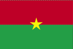
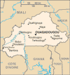
| COUNTRY FACTS: BURKINA FASO | |
|---|---|
| Name(official): | Burkina Faso |
| Name(short): | Burkina Faso |
| Capital City: | Ouagadougou |
| Location: | Western Africa |
| Coordinate: | 13 00 N, 2 00 W |
| Independence: | (From France) August 5; 1960 |
| President: | Blaise Compaore (President), Paramanga Ernest Yonli (Prime Minister) |
| Type of Government: | Parliamentary Republic |
| Total Area: | 274 200sq.km. |
| Population: | 13 902 972 |
| People: | Mossi over 40%, Gurunsi, Senufo, Lobi, Bobo, Mande, Fulani |
| Religion: | Muslim 50%, indigenous beliefs 40%, Christian (mainly Roman Catholic) 10% |
| Languages: | French(official), native Afrcan languages belonging to Sudanic family spoken by 90% of the population |
| Literacy: | 26.6%total, 36.9%male, 16.6%female (2003 est.) |
| Currency: | Communaute Financiere Africaine Franc (1CFAF =100centimes) |
| GDP(per capita): | $1 200 (2005 est.) |
| Arable Land: | 17.66% (2005 est.) |
| Agriculture: | Cotton, peanuts, shea nuts, sesame, sorghum, millet, corn, rice, livestock. |
| Natural resources: | manganese, limestone, marble, small deposit of gold, phosphate, pumice, salt. |
| Embassy in Japan: | Embassy of Burkina Faso Chancery: Hiroo Glisten Hills 3F, 3-1-17, Hiroo, Shibuya-ku. Post Code: 150-0012 Tel. 03-3400-7919 Embassy of Burkina Faso |
| General Info: | Burkina Faso Embassy, U.S.A. |
| International Phone Code: | +226 |
ECONOMY: BUSINESS, TRADE AND INVESTMENT
- Ministry of Economy and Finance
- Tourism:
MAJOR CITIES
Bobo-Dioulasso, Koudougou, Ouagadougou, Banfora, ouahigouya.
NEWS
INTERNATIONAL ORGANIZATIONS:
GOVERNMENT: ADMINISTRATIVE UNITS
45 provinces: Balé, BAM, BANWA, Bazéga, BOUGOURIBA, BOULGOU, BOULKIEMDE, Comoé, GANZOURGOU, GNAGNA, GOURMA, HOUET, IOBA, KADIOGO, Kénédougou, KOMONDJARI, KOMPIENGA, KOSSI, Koulpélogo, KOURITTENGA, Kourwéogo, Léraba, LOROUM, MOUHOUN, NAHOURI, NAMENTENGA, NAYALA, NOUMBIEL, OUBRITENGA, OUDALAN, Passoré, PONI, Sanguié, SANMATENGA, Séno, SISSILI, SOUM, SOUROU, TAPOA, TUY, YAGHA, YATENGA, ZIRO, ZONDOMA, Zoundwéogo


