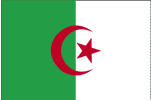
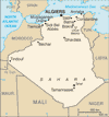
| COUNTRY FACTS: ALGERIA | |
|---|---|
| Name(official): | People's Republic of Algeria |
| Name(short): | Algeria |
| Capital City: | Algiers |
| Location: | North Africa |
| Coordinate: | 28 00 N, 3 00 E |
| Independence: | (from France) July 5th, 1962 |
| President: |
|
| Type of Government: | Republic |
| Total Area: | 2 381 741sq.km. |
| Population: | 32 930 091 (July 2006 est.) |
| People: | Arab-Berber 99%, European less than 1%
Note: almost all Algerians are Berber in origin, not Arab; the minority who identify themselves as Berber live mostly in the mountainous region of Kabylie east of Algiers; the Berbers are also Muslim but identify with their Berber rather than Arab cultural heritage; Berbers have long agitated, sometimes violently, for autonomy; the government is unlikely to grant autonomy but has offered to begin sponsoring teaching Berber language in schools. |
| Religion: | 99%Muslim(state religion), 1% Jews and christians |
| Languages: | Arabic(official), French and Berber |
| Literacy: | 70%total, 78.8%male, 61%female (2003 est.) |
| Currency: | Algerian Dinar(1DZD= 100centimes) |
| GDP(per capita): | $7 200 (2005 est.) |
| Arable Land: | 3.17% |
| Agriculture: | wheat, barley, oats, grapes, citrus, fruits, sheep, cattles |
| Natural resources: | Petroleum, natural gas, iron ore, phosphate, uranium, lead, zinc |
| Embassy in Japan: | Embassy of the People's Democratic Republic of Algeria,
Chancery: 2-10-67, Mita, Meguro-ku.
Post Code: 153-0062,
Tel. 03-3711-2661
|
| General Info: | |
| International Phone Code: | +213 |
ECONOMY: BUSINESS, TRADE AND INVESTMENT
- National Center for Commercial Registration CNRC
- Algerian Ministry of Energy and Mining
- Algeria Ministry of Finance
- Bank of Algeria
- Tourism:
- Ministry of Tourism and Handcraft
- National Office of Tourism
- Atlas Mountains
- Tassli n'Ajjer National Park
- El Kala National Park
- Timgad, Batner
- Kasbah (Historic sites), Algiers
- Djemila (Ancient ruins), Setif
MAJOR CITIES
Algiers, Constantine, Oran, Annaba, Batna, Blida, Setif, Djelfa, Sidi Bel Abbes.
NEWS
- Algeria News Agency
- Algeria National TV
- FM Radio
- The Algerian Press Portal
- All About Algeria
- Ministry of Youth and Sports
INTERNATIONAL ORGANIZATIONS:
- United Nations
- African Union
- LEAGUE OF ARAB STATES
- UMA
- NEPAD
GOVERNMENT: ADMINISTRATIVE UNITS
48 provinces (wilayat, singular - wilaya); Adrar, Ain Defla, Ain Temouchent, Alger, Annaba, Batna, Bechar, Bejaia, Biskra, Blida, Bordj Bou Arreridj, Bouira, Boumerdes, Chlef, Constantine, Djelfa, El Bayadh, El Oued, El Tarf, Ghardaia, Guelma, Illizi, Jijel, Khenchela, Laghouat, Mascara, Medea, Mila, Mostaganem, M'Sila, Naama, Oran, Ouargla, Oum el Bouaghi, Relizane, Saida, Setif, Sidi Bel Abbes, Skikda, Souk Ahras, Tamanghasset, Tebessa, Tiaret, Tindouf, Tipaza, Tissemsilt, Tizi Ouzou, Tlemcen


