

| COUNTRY FACTS: SENEGAL | |
|---|---|
| Name(official): | Republic of Senegal |
| Name(short): | Senegal |
| Capital City: | Dakar |
| Location: | Western Africa |
| Coordinate: | 14 00 N, 14 00 W |
| Independence: | (from France) April 4th; 1960. |
| President: | Abdoulaiye Wade |
| Type of Government: | Republic |
| Total Area: | 196 190sq.km. |
| Population: | 13 711 597 (2009 est.) |
| People: | Wolof 43.3%, Pular 23.8%, Serer 14.7%, Jola 3.7%, Mandinka 3%, Soninke 1.1%, European and Lebanese 1%, other 9.4%. |
| Religion: | muslim94%, christians(mostly catholics) 5%, indigenous belief1%. |
| Languages: | French(official), Wolof, Pulaar, Jola, Mandinka. |
| Literacy: | 40.2%total, 50%male, 30.7%female (2003 est.) |
| Currency: | Communaute Financiere Africaine Franc (1CFAF =100centimes) |
| GDP(per capita): | $1 700 (2008 est.) |
| Arable Land: | 12.51% (2005 est.) |
| Agriculture: | Cotton, cattle, rice, corn, millet, peanuts, sorghum, tomatoes, green vegetables, fish, poultry, pork. |
| Natural resources: | Iron ore, fish, potash. |
| Embassy in Japan: | Embassy of the Republic of Senegal, Chancery: 1-3-4, Aobadai, Meguro-ku. Post Code: 153-0042, Tel. 03-3464-8451 |
| General Info: | News, Tourism and General Info |
| International Phone Code: | +221 |
ECONOMY: BUSINESS, TRADE AND INVESTMENT
- Investment Promotion Agency
- Tourism: The main tourist attractions are ....
- Goree -"Maison Des Esclaves"("House of Slaves"), embarkation point for slaves from Africa to the Americas.
- Djoudj National Park For Birds(one of the best in the world), North of Saint Louis.
- Lanque de Barbariee National Park and the Guembeul Special Reserve for fauna, South of Saint Louis.
- Niokolo Koba National Park (one of the most important reserves in West Africa), Eastern Senegal.
- Ministry of Tourism (French)
- Senegal Tourism, NY Office
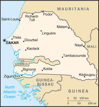
MAJOR CITIES
Dakar, Touba, Thiés, Rufisque, Kaolack, M'Bour, Richard Toll, Ziguinchor, Saint Louis, Diourbel, Louga, Tambacounda
NEWS
INTERNATIONAL ORGANIZATIONS:
- United Nations
- African Union
- ECOWAS
- NEPAD
- CEN-SAD
GOVERNMENT: ADMINISTRATIVE UNITS
Senegal has 11 regions, namely:
Dakar, Diourbel, Fatick, Kaolack, Kolda, Louga, Matam, Saint-Louis, Tambacounda, Thies, Ziguinchor.