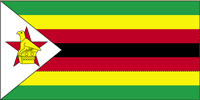
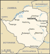
| COUNTRY FACTS: ZIMBABWE | |
|---|---|
| Name(official): | Republic of Zimbabwe |
| Name(short): | Zimbabwe |
| Capital City: | Harare |
| Location: | Southern Africa, between South Africa and Zambia. |
| Coordinate: | 20 00 S, 30 00 E |
| Independence: | (From Britain) April 18th; 1980. |
| President: | Robert Gabriel MUGABE - President(since independent, 1980) Morgan Tsvangirai; Prime Minister(since Feb. 11th 2009) in a power-sharing government. He won the first round of the Presidential election in 2008 but withdrew from the run-off with Mugabe after widespread violence sponsored by the ruling ZANU-PF party |
| Type of Government: | Parliamentary democracy |
| Total Area: | 390 580sq.km. |
| Population: | 12 236 805 (JULY 2006) |
| People: | African 98% (Shona 82%, Ndebele 14%, other 2%), mixed and Asian 1%, white less than 1%. |
| Religion: | syncretic (part Christian, part indigenous beliefs) 50%, Christian 25%, indigenous beliefs 24%, Muslim and other 1%. |
| Languages: | English (official), Shona, Sindebele (the language of the Ndebele, sometimes called Ndebele), numerous but minor tribal dialects. |
| Literacy: | 90.7%total, 94.2%male, 87.2%female (July 2006) |
| Currency: | Zimbabwean dollar (ZWD) |
| GDP(per capita): | $2 100 (2005) |
| Arable Land: | 8.24% (2005) |
| Agriculture: | Corn, cotton, tobacco, wheat, coffee, sugarcane, peanuts, sheep, goats, pigs. |
| Natural resources: | coal, chromium ore, asbestos, gold, nickel, copper, iron ore, vanadium, lithium, tin, platinum group metals. |
| Embassy in Japan: | Embassy of the Republic of Zimbabwe, Chancery: 5-9-10, Shiroganedai, Minato-ku. Post Code: 108-0071, Tel. 03-3280-0331/2 |
| General Info: | |
| International Phone Code: | +263 |
ECONOMY: BUSINESS, TRADE AND INVESTMENT
- Reserve Bank of Zimbabwe
- Export Processing Zone
- Zimbabwe Investment Center
- Zimtrade
- One Business Zimbabwe
- Tourism:
- Harare International Festival of the Arts (HIFA) (Annual Festival in April, one of the best in the world)
- Zimbabwe International Film festival (Holds in August every year)
- Zimbabwe Tourist Authority
- The Ruins of Great Zimbabwe
- Victoria Falls (World famous)
- Zambezi River
- Lake Kariba (One of the world's largest man-made dams)
- Gonarezhou National Park
- Hwangwe National Park (one of Africa's finest conservation areas)
- Mana Pool National Park (a World Heritage Site)
- Matusadora National Park (After Ngorongoro, Matusadora has the 2nd largest concentration of lions in Africa).
- National Museum & Monuments of Zimbabwe
MAJOR CITIES
Bulawayo, Bindura, Betbridge, Chinhoyi, Harare, Marondera, Masvinga, Mutare, Gweru, Kariba, Kwekwe, Kadoma, Victoria Falls
NEWS
INTERNATIONAL ORGANIZATIONS:
- United Nations
- African Union
- COMESA
- SADC
- NEPAD
GOVERNMENT: ADMINISTRATIVE UNITS
8 provinces and 2 cities* with provincial status; Bulawayo*, Harare*, Manicaland, Mashonaland Central, Mashonaland East, Mashonaland West, Masvingo, Matabeleland North, Matabeleland South, Midlands.


