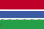
| COUNTRY FACTS: GAMBIA | |
|---|---|
| Name(official): | Republic of The Gambia |
| Name(short): | The Gambia |
| Capital City: | Banjul |
| Location: | Western Africa, bordering the North Atlantic Ocean and senegal. Click to enlarge
 Map of Gambia |
| Coordinate: | 13 28 N, 16 34 W |
| Independence: | (From Britain) February 18th; 1965. |
| President: | Yahya A.J.J. JAMMEH - President Isatou Njie SAIDY - V.P. |
| Type of Government: | Republic |
| Total Area: | 11 300sq.km. |
| Population: | 1 641 564 (July 2006 est.) |
| People: | African 99% (Mandinka 42%, Fula 18%, Wolof 16%, Jola 10%, Serahuli 9%, other 4%), non-African 1%. |
| Religion: | Muslim 90%, Christian 9%, indigenous beliefs 1% |
| Languages: | English (Official), Mandinka, Wolof, Fula, other indigenous vernaculars. |
| Literacy: | 40.1%total, 47.8%male, 32.8%female (2003 est.) |
| Currency: | dalasi (GMD) |
| GDP(per capita): | $1 900 (2005 est.) |
| Arable Land: | 27.88 (2005 est.)% |
| Agriculture: | Rice, millet, sorghum, peanuts, corn, sesame, cassava (tapioca), palm kernels; cattle, sheep, goats. |
| Natural resources: | fish titanium(rutile and ilmenite), tin, zircon, silica sand, clay, petroleum. |
| Embassy in Japan: |
|
| General Info: | The Gambia - Web Directory |
| International Phone Code: | +220 |
ECONOMY: BUSINESS, TRADE AND INVESTMENT
MAJOR CITIES
Serrekunda, Kanifeng, Brikama, Banjul.
NEWS
INTERNATIONAL ORGANIZATIONS:
- United Nations
- African Union
- ECOWAS
- CEN-SAD
- NEPAD
GOVERNMENT: ADMINISTRATIVE UNITS
5 divisions: Central River, Lower River, North Bank, Upper River, Western.And 1 city; Banjul.


